Historian Era: The Streets Before The Tapestry
The Streets Before The Tapestry
A Personal Look at the History of Gildart Street, Kempston Street & Constance Street
19th-Century Origins: From Gardens to Streets

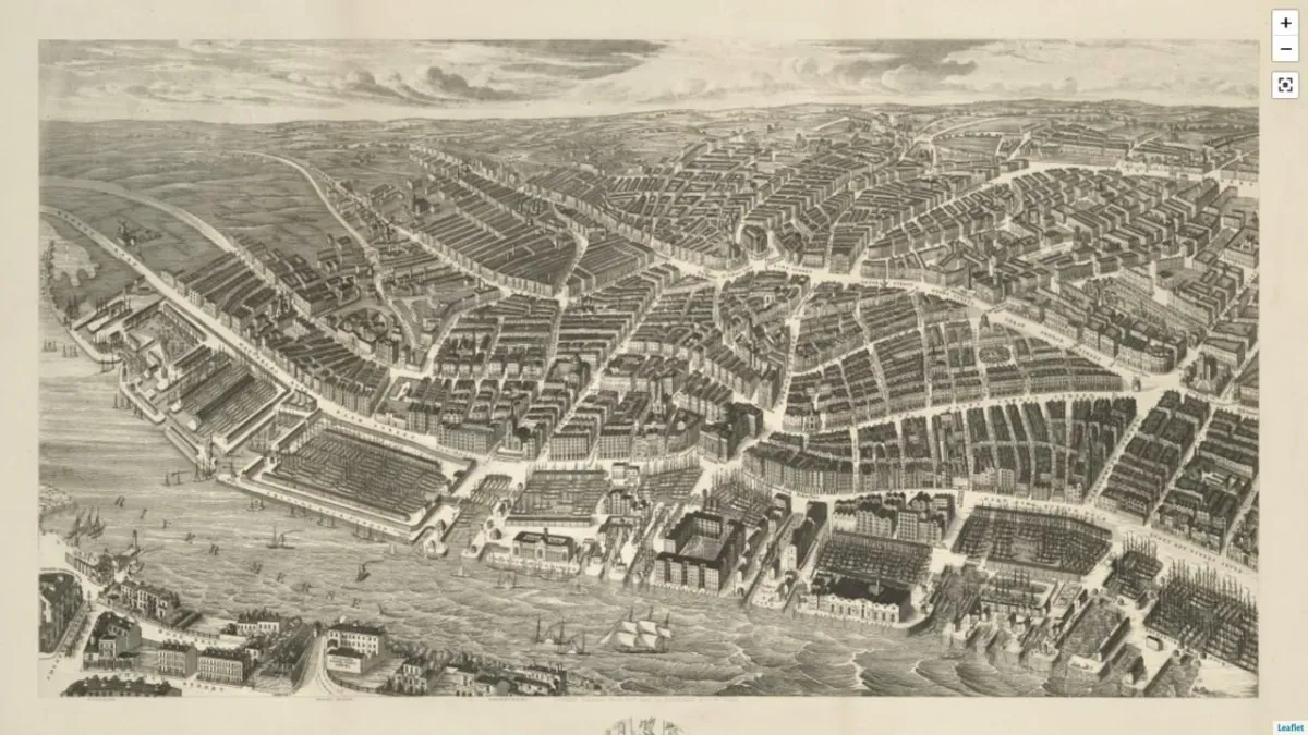
Vintage Map of Liverpool 1851
Before The Tapestry became what it is today, we wanted to dig into the roots of the area — and it’s fair to say, the history runs deep. Gildart Street, Kempston Street and Constance Street all sit in Liverpool’s historic Islington district, a place that’s changed massively over the years.
We discovered that Gildart Street was named after Richard Gildart, an 18th-century merchant and three-time Mayor of Liverpool in the 1730s. Not exactly something to be proud of — he made much of his wealth through the Atlantic slave trade. It’s important to acknowledge that side of the history, even if it's uncomfortable. The land around here used to be known as Gildart’s Gardens, which by the mid-1800s had become overcrowded tenements, mostly home to the very poor.

Gildart Gardens
As Liverpool’s population boomed — especially during the Irish famine in the 1840s — new streets were carved out of the old gardens and courts.
Kempston Street actually had a few name changes; it started out as Finch Street, then by 1868, it was renamed Blandford Street. In fact, the building where Scale Liverpool and Game Over are now (and part of Does Liverpool’s space too) used to be the site of St Mary Magdalene’s Church. It was a modest little Anglican church, serving a working-class parish, and had been there before 1829.

Court Housing Dwellings
Meanwhile, Constance Street (where you’ll now find Hopscotch, Aeternum, Flamingo Boulevard, and the other half of Does Liverpool’s space) was laid out as a short side street off Gildart Street. It was filled with back-to-back terraces and court housing — classic 19th-century Liverpool slums. The current site of Commune used to be the vicar’s residence linked to St Mary Magdalene’s.
Back then, these streets were mostly residential, but “residential” didn’t mean comfort — more like crammed courts, lodging houses, and the odd corner shop or church. It was tight living with very little space or sanitation.
We discovered that the Islington area used to be known as Folly Lane, as far back as 1785. It was farmland back then, with early development starting on Norton Street and Stafford Street, where there was even a smithy and forge.
Old maps from around 1864 paint a clear picture — Blandford Street (what’s now Kempston Street) was filled with narrow courts and clusters of tiny houses. These setups stuck around into the 1890s, and by 1891, maps still showed packed court dwellings all along the back streets. These places were grim, with barely any ventilation and rough living conditions. Constance Street was one of those spots, with multiple families squeezed into tiny terraced homes.
There’s more to come as we continue exploring the history of The Tapestry and the area now known as the Fabric District. Keep an eye out for the next piece in the series — this story is just getting started.